escotiaworks.com

Tuesday, August 7, 2007

Toronto And Home


The Ambasssdor Bridge, We are Almost Home!

Tuesday morning I awoke with only one thought, "to go home." We had been on the road four and half weeks and we were ready. Unfortunately this meant we would not be stopping in Montreal to meet up with a friend and eat a smoked meat sandwich or visiting the Insectarium de Montreal.

So we loaded up the car had breakfast and headed west. We crossed northern New York and over into Ontario, Canada. We hit traffic just east of Toronto and that would be the norm until we got to Woodstock west of Toronto. We did make a quick stop in downtown Toronto to go to Mountain Equipment Co-op. There was a bag that I saw in the Halifax, NS store that I wanted to buy.

It then started to rain and the traffic got worse. We averaged about 20 mph for the next 70 miles. Eventually it did break up and the rain stopped. Before we knew it we were crossing the Ambassador Bridge over the Detroit River and into the USA. We got through customs quickly and we were home hugging Mom by 9:30 pm.


Plattsburgh, NY to Ypsilanti, MI, 618 miles 12 hrs 2 min

Labels: , , , , , , ,

Friday, August 3, 2007

A Day Of Superlatives And The Return To Acadia


Joe, Ned and Lobsterman With the World's Largest Lobster

Friday morning we were up early and on our way. In the planning phase of the trip I was going to go to Quebec City from Prince Edward Island. It was the one part of the trip that I didn’t like. Not Quebec, but the drive there. 12 hours plus from PEI through a lot of backwoods. So when we left PEI it was with the idea of going back through New Brunswick, Maine, New Hampshire, Vermont and then up to Montreal.

We took the Confederation Bridge to get off of the island. The 14 km long Confederation Bridge was built in 1997 as an alternative way to get to PEI from the Canadian mainland. When we crossed it was very hazy so that you couldn’t see far across the bridge.


PEI in the Rearview Mirror and New Brunswick in the Distance


The Confederation Bridge the Longest Bridge to Span Ice Covered Waters

Once in New Brunswick we took a side trip to Shediac, NB to see the World’s Largest Lobster. The Shediac lobster is 35 ft long and sits at the entrance to the east side of town. From Shediac and the Lobster we stopped a Hartland, NB to see the Longest Covered Bridge in the World. The first of many covered bridges we would see in the next few days but certainly the longest.


Joe Having Lobster Problems


The Sign Says It All

From Hartland, NB it is a quick drive to the border of Maine and the USA though it took about 30 minutes to cross. While we were waiting a thunderstorm blew in and knocked the power out but after answering the border agent’s questions and having him search the back of the car we were back in the USA. At this point I wasn’t sure where we going. I thought of going to Baxter State Park but with the storm blowing through I passed on it. As I looked at the map I realized we were going to be close to Acadia again. When I mentioned this out loud the boys both asked if we could go back. After a quick stop in Bangor we did.

The problem with visiting Acadia National Park on the spur of the moment, in August, late in the day is that we had a hard time finding a place to stay. We ended up on the Western part of Mount Desert Island at a private campground. They found a site for us and we set up camp in the dark.


Cavendish, PEI to Acadia National Park, ME, 504 miles 12 hrs 7 min

Labels: , , , , , , ,

Thursday, August 2, 2007

Three Days On Prince Edward Island


Joe and Ned Visiting Anne's House

On July 31 we were up early because we slept in the car the night before. We found a spot to have breakfast and then went to the Cavendish campground for PEI National Park. We got on the waiting list for a campsite and then went to visit the sites.

The main attraction in Cavnedish is the Green Gables Heritage Site. It is the house that inspired Lucy Maud Montgomery's vision of the home where Anne Shirley lives in Anne of Green Gables. Since we were there so early we were the only ones there and we were able to explore the home and grounds without having to jostle or wait our turn. On the site is a trail through the Haunted Woods and Lovers' Lane both from the story.


Anne's Bedroom


Ned Tries Milking


Down Lovers' Lane


The Red Earth of Prince Edward Island

After visiting Green Gables we went down the road and stopped at the Lucy Maud Montgomery homestead site. The building is gone and only the cellar remains of the home in which she was raised by her grandparents. There are paths that lead from there to the cemetary where she is buried.

We then went into Charlottetown to visit the library and do some shopping. When we got back to the PEI National Park we did get a campsite.

The next two days were laid back ones. We went to the beach which was about 150 yards from the campsite. The beach is lovely wide and long and mostly empty of people. The water seemed cold at first but once in was nice. We spent most of the beach time making large river systems in the sand.


Joe and Ned are Ready for the Beach


One of the Rivers


Prince Edward Island National Park


Walking Back to Camp

We also stopped for ice cream at Cows a PEI ice cream chain that is very good. One night we played mini-golf at a golf course with a giant lobster. It was very relaxing and the weather was great. We were only going to be there two days but it was so nice we stayed an extra day.


Relaxing at the Campsite


Ned Swings by the Potatoes


The Lobster Trap

Labels: , , , , , , ,

Monday, July 30, 2007

Fortress of Louisbourg And Alexander Graham Bell


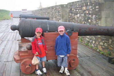
Ned and Joe at Fortress of Louisbourg

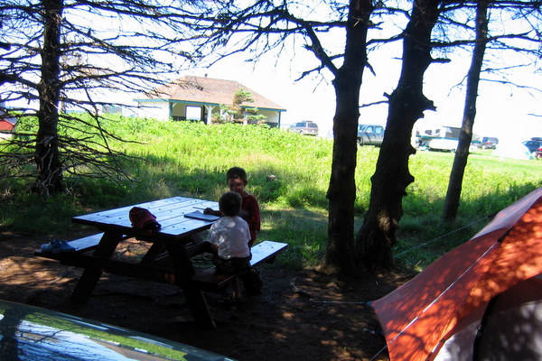
Monday started off wet. It rained all night and into the morning. A good hard rain when you are in a tent is not. After about the fifth hour I started to notice that the tent was leaking in a few spots. Fortunately the rain stopped around 7:30 am and the tent leaked very little, nothing a few socks were not able to soak up.

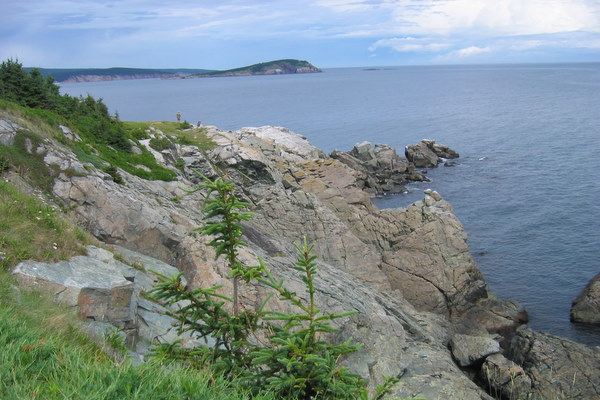
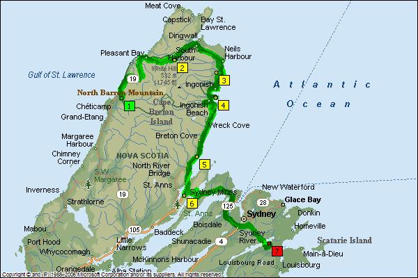
The reason we were in the Southeast corner of Nova Scotia was to visit the 
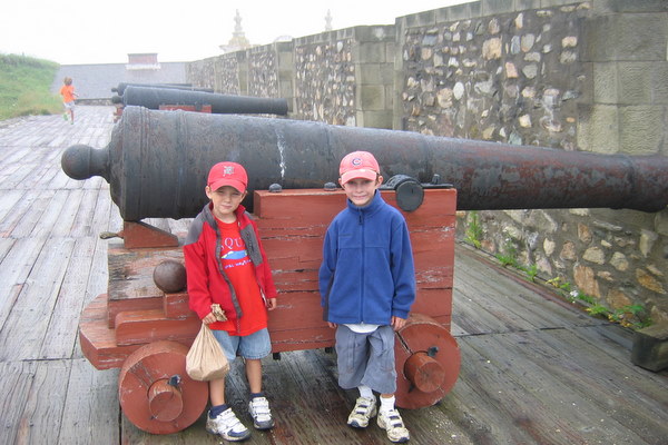
Fortress of Louisbourg. The fortress was founded by the French in 1719 to protect their lucrative cod fisheries. Unfortunately they were competing with the British over this and the control over North America. In 1745 the British lay seige and captured the town. It was given back to the French three years later by treaty. In 1758 the British again captured the town and this time razed it.

In 1961 the Canadian government began a reconstruction of the town and fortifications. When you enter the town you are transported back to 1744 a year before the first siege. There are re-enactors throughout the village and fortress taking on the different roles of bakers, soldiers, cooks, fisherman etc. When you try to enter the gate the soldier on guard demanded to know where we from and what our business was. He quite put off to find that we were "British" and possible spies. Ned vouched for us we were allowed to enter.

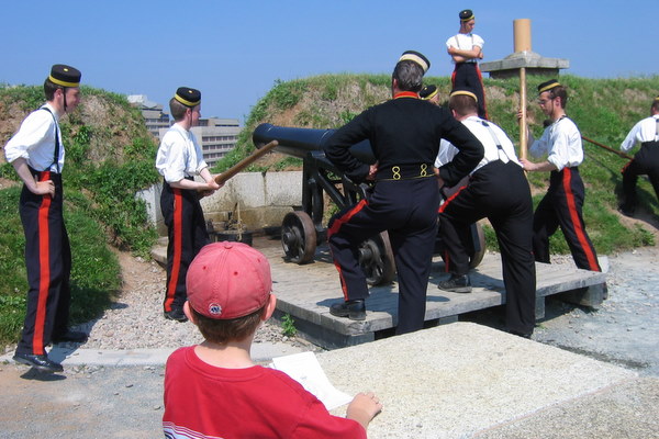
Because of the wet weather I thought our visit was a bit more realistic. The fog was thick and nothing could be seen beyond the town. The ground was muddy and people had mud on them. The downside was being cold and wet. We still spent about five hours there looking in the different buildings, watching the blacksmiths, talking to the villagers, watching a cannon being fired and having a meal at one of the taverns.


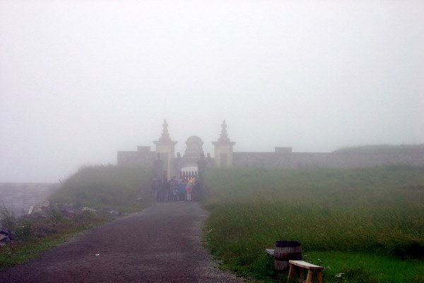
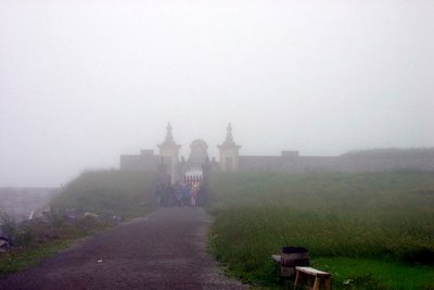
The Approach to the Fortress of Loiusbourg


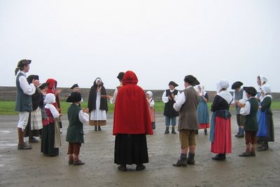
The Children at Dance and Song


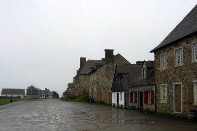
The Waterfront Street of Louisbourg
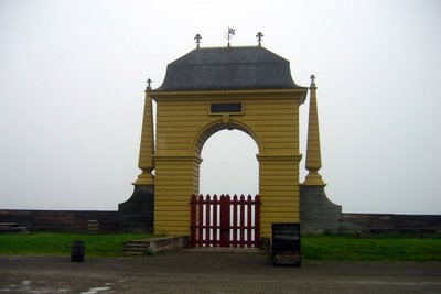

The Frederick Gate


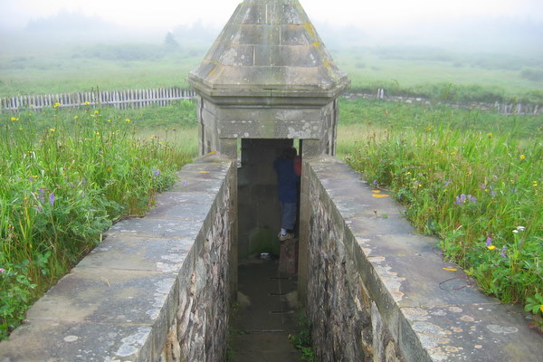
Joe Watches for the British


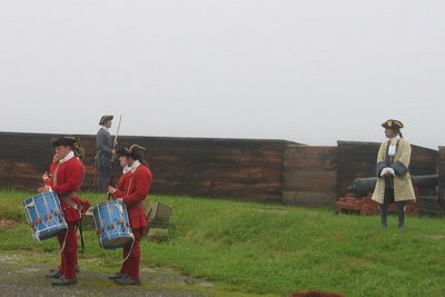
Overseeing the Troops


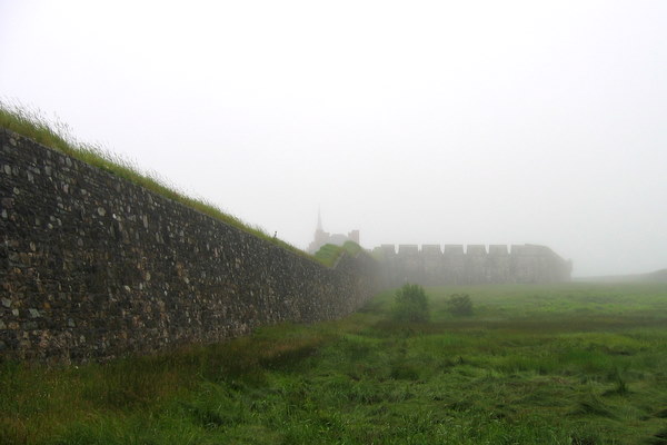
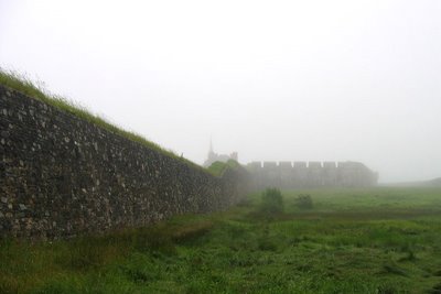
The Fortress Wall in the Fog


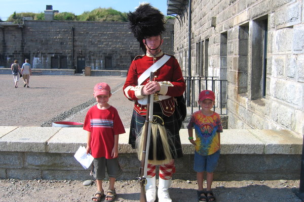
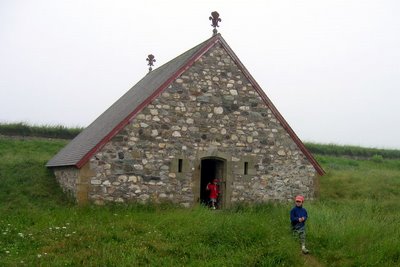
Ned and Joe Visiting


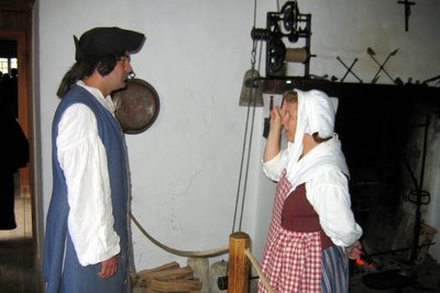
Conversing in the Kitchen

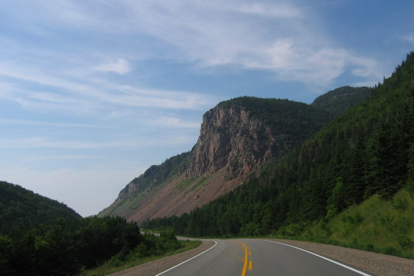
Saying au revoir to the fortress we started for Prince Edward Island. On the way we made a stop in Baddeck, NS, to visit the 
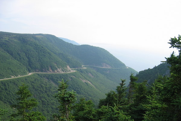
Alexander Graham Bell National Historic Site. Bell decided to build a vacation home in Baddeck in 1885 after visiting because in his words, "I have traveled the globe. I have seen the Canadian and American Rockies, the Andes and the Alps and the highlands of Scotland, but for simple beauty, Cape Breton outrivals them all." The museum has exhibits on Bell´s wide ranging interests and inventions, much of it undertaken at Baddeck.

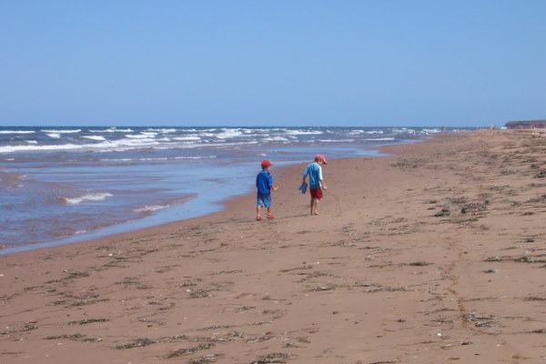
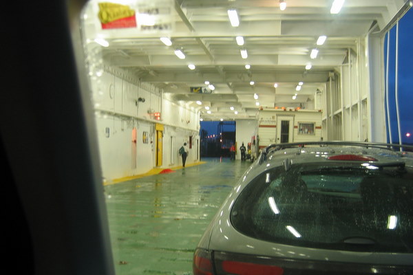
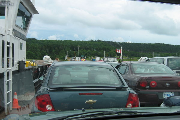
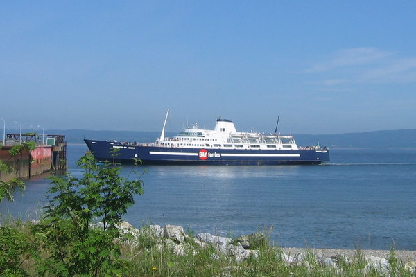
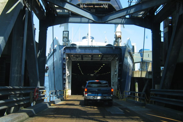
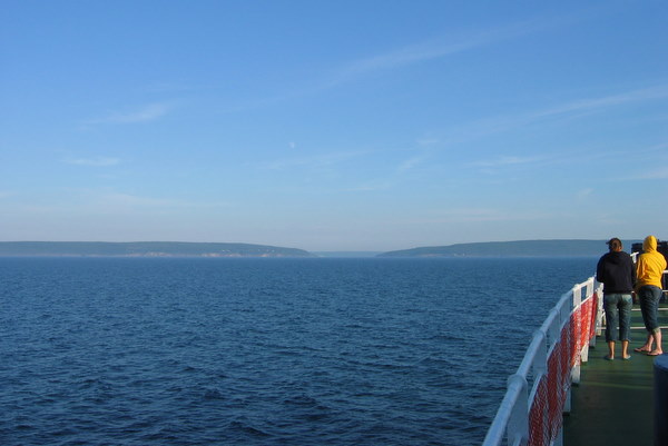
We managed to catch the 7:30 pm ferry to Prince Edward Island and we soon found ourselves in Cavendish. Originally I wasn't going to take the ferry to PEI but I found out that you have to pay one way, to get off the island. I had planned on staying at one of the campgrounds in Prince Edward Island National Park. After driving around for a while I could not find it and after stopping to ask for directions found out that it was shutdown three to four years prior. So much for guide books, I should have called. We went to one of the other campgrounds and ending up sleeping in the car. The facilities were in such bad shape that I decided in the morning we would go to a different campground.


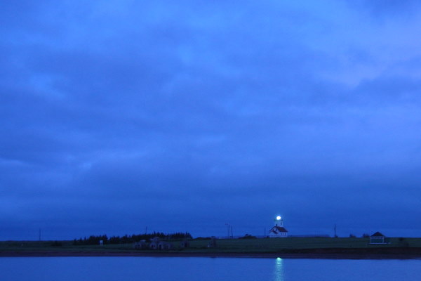
The Ferry to Prince Edward Island


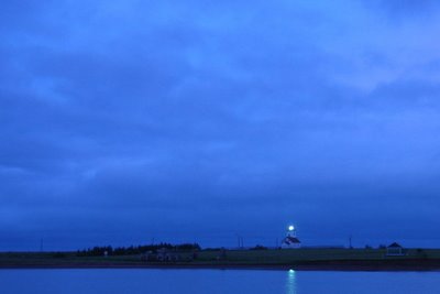
The Woods Island Light on Prince Edward Island


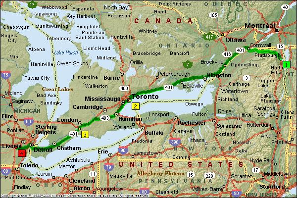
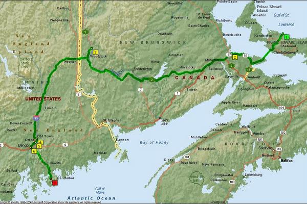
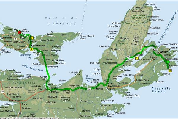
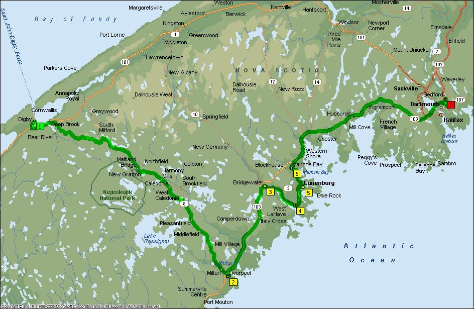
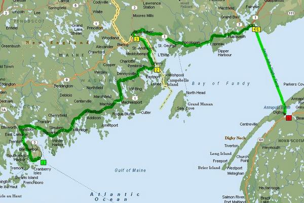
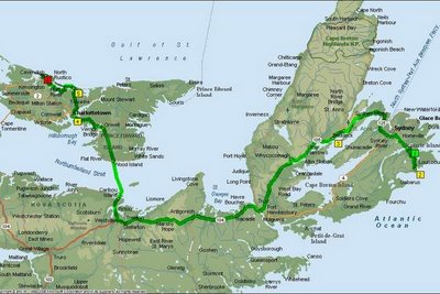
Louisbourg, NS to Cavendish, PEI, 310 miles 6 hrs 25 min

Labels: , , , , , , ,

Sunday, July 29, 2007

Driving The Cabot Trail


Ned and Joe Posing in the Role of Moose

The next morning the weather looked like rain but it hadn't started by the time we broke camp. We set off. It would take three to four hours to drive the Cabot Trail without stops. That is impossible. Perhaps if you have driven it ten or more times you might become immune to the views. It took us almost seven hours. We stopped at many overlooks and hiked some of the trails. We drove up side roads to see waterfalls. There is still more that I would have like to see.

Our first stop other than a scenic pullout was at MacIntosh Brook. It is about a one and half mile hike through an old growth forest along a brook with small waterfalls. It was a good early morning way to loosen the legs and wake us up. The parking area has a kitchen shelter and when we finished the hike we fired up the stove and had our breakfast. While we ate it began to pour so our next stop wasn't until Beulach Ban Falls a bit further down the road. We continued along the Cabot Trail until we came to the Atlantic coast where we stopped at Green Cove.


Looking Down to Fishing Cove


The View to Pleasant Bay


I'm Telling You There are No Moose!

Green Cove is a small rocky headland that juts out into the ocean. It is formed of some really neat boulders of pinkish rock with intrusions of a highly crystalized granite forming lines and crosses. Down the road from there we turned down a side road to view Mary Ann Falls. They were crowded and there were people swimming the pools beneath them.


Green Cove


Joe and Ned Clamboring Over the Boulders

Our last stop along the Cabot Trail was to hike Middle Head. Middle Head is a long headland creating North and South Ingonish Bays. It is a two and half mile hike starting at the Keltic Lodge. The hike goes through some forests and meadows and has rocky cliffs on the sides and at the end for great views up the coast and to Cape Smokey to the south.

Wildflowers


Go Ahead Jump


The End of Middle Head


The Keltic Lodge Near Ignonish, NS

After the hike we said goodbye to the Cabot Trail and headed for the Southeast corner of Cape Breton Island taking the ferry at Englishtown and camping south of Sydney, NS at Mira River Provincal Park.


The Englishtown Ferry


Chéticamp, NS to Mira River, NS, 165 miles 8 hrs 28 min

Labels: , , , , , ,

Saturday, July 28, 2007

To Cape Breton Island


The Cabot Trail

From Halifax we headed for Cape Breton Island and the Cabot Trail. Along the way we stopped in Stellarton to visit the Nova Scotia Museum of Industry. It is a hands on exploration of the industries in Nova Scotia from the past to the present. We were early so some displays were not quite set up but the boys had a good time.


Ned the Engineer


Tire Boys

Crossing the Canso Causeway we entered Cape Breton Island. At this point there are a number of ways to go and I decided to take the northerly, coast hugging Highway 19 the Ceilidh Trail. It is a pretty drive and we soon arrived in Chéticamp which for us was the beginning of the Cabot Trail.

The Cabot Trail is a 180 mile drive around the northern part of Cape Breton Island most of it being inside Cape Breton Highlands National Park. It is a beautiful drive with many pulloffs to view the vistas of deep valleys, mountains and ocean.

After we arrived in Chéticamp we made camp at the National Park's Chéticamp campground. It was early so we headed up the Cabot Trail a few miles to hike the Skyline Trial. The Skyline is 6 mile loop that goes out onto a headland about 950 ft above the ocean. Views are spectacular. The trail back is through a forest where moose are often spotted. We saw lots of moose sign but the only mammal was a lone ground squirrel. The woods were full of bird calls clear and bright.

On the way back to the campsite we saw a group of people on the side of the road with cameras. Slowing down to take a look we saw they were looking at a bull moose. He was munching his way around a shrub. He would be our only moose sighting. Other travellers I talked to reported seeing mothers and calves, two bulls, black bears and cubs, and bald eagles. One woman from the Netherlands told me they saw six moose. We saw only the one moose and ground squirrels. Bird wise is was terns, gulls, cormorants and crows.


The Cabot Trail Looking South


The Skyline Trail Boardwalk


Wildflowers and Tree Trunk


Our Only Moose


The Cabot Trail Winding Its Way North


Halifax, NS to Chéticamp, NS, 266 miles 7 hrs 8 miin

Labels: , , , , , ,

Friday, July 27, 2007

To And About Halifax, Nova Scotia


Joe Ask the Highlanders What Is Under...the Big Stone Behind Them

The drive to Halifax was interesting. We stopped in Annapolis Royale to visit the Annapolis Tidal Generating Station. It is the only generating plant in North America using the energy from tides. The boys were disappointed because they wanted to go on a tour but you had to be 16 or older. We then headed across the interior of Nova Scotia passing by Kejimkujik National Park. Just south of there we almost wrecked the car when we came around a turn and found a black bear in the middle of the road. It was large cub and once it saw us it quickly ran into the woods. I thought it wise not to follow.


The Annapolis Tidal Generating Station

After a quick visit to the town of Liverpool we next stopped at Lunenburg. Lunenburg is a UN designated World Heritage Site but I mostly wanted to see the Bluenose. Unfortunately it was in Prince Edward Island. We moved on through Mahone Bay, the city of churches and very near Oak Island home of the money pit. Soon we were in Halifax.

We camped in Dartmouth across the harbor at Shubie Park. On Friday, July 27, morning we drove into Dartmouth and took the commuter ferry across the harbor to Halifax. We wandered down the harbor front and visited with Theodore Tugboat before going to the Maritime Museum of the Atlantic. The museum contains boats, models of boats and ships, a chandlery, shipwrecks including relics from the Titanic and a pirate exhibit. There is quite a bit to see and we spent a lot longer there than I had planned.


Halifax from the Ferry


Halifax is Big Harbour of Theodore Tugboat


The Only Deck Chair Recovered from the Titanic


We had to get back to the car since our meter was running out so hopped the ferry back and then drove into the city to visit the the Halifax Citadel.

It is on a hill overlooking the city and is very impressive. The boys loved it especially Joe. I think we explored every nook of the place. They have a History Hunt that if you get all of the questions correct you get a free cookie which the boys both received.

After the Citadel we stopped at the Halifax Public gardens for a quick stroll then headed back to the campsite. I wanted to get up early tomorrow to make the drive to Cape Breton Island.


Joe Taking Notes on How to Fire a Cannon


New Recruits Ready For Duty


The Halifax Public Gardens are Beautiful


Digby, NS to Halifax, NS, 230 miles 7 hrs 17 min

Labels: , , , , , ,

Wednesday, July 25, 2007

Reversing Falls, A Ferry, And Whales


A Trip Through Maine Is Not Complete Without Blueberries

We left later than we wanted from Acadia National Park. Perhaps it was the park keeping me from getting up when alarm went off or it calling for me to stay and linger a little bit longer. But we did get up and broke camp and headed for Canada.

We took the scenic Route 1 along the Maine coast but because of the late start we could not stop long the way. When we reached Calais we had lunch and a fifteen minute wait at the border. We managed to get to St. John, New Brunswick with enough time to stop and view the Reversing Falls. They are rapids on the St John river that reverse direction when the tide comes in. It takes a while to watch them reverse, about 5 hours. We went to catch the ferry.

The ferry trip was nice. The ship was large and comfortable. We watched a movie and Joe and I saw some whales from the deck. One was spouting and I saw a whale tail. There were some porpoises swimming in the bow wake but when we got there they were gone. It was late when we got in so we decided to stay at an hotel in Digby, NS.


The Reversing Falls

Our Ship Comes In


The Bow Opens to Let Us In


Driving on the Princess of Acadia


Nova Scotia

Bar Harbor, ME to Digby, NS, 215 miles 8 hrs 59 min (Including time on ferry)

Labels: , , , , , , ,