escotiaworks.com

Saturday, August 4, 2007

We Are Back In Acadia National Park


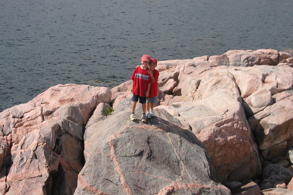
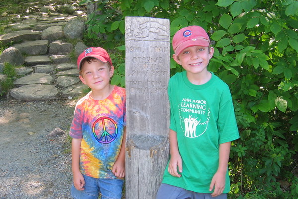
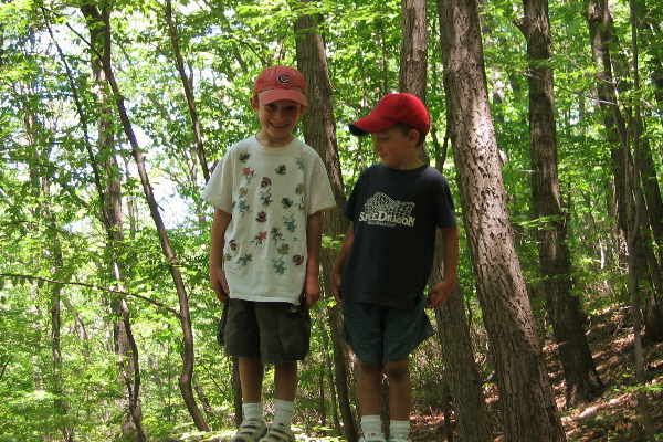
Joe and Ned are Ready to Hike

We are back in Acadia National Park? Yes indeed. When we left last time I said I would be back but I didn't know it would be this soon and unfortunately without Mary. Well we so close how could we resist.

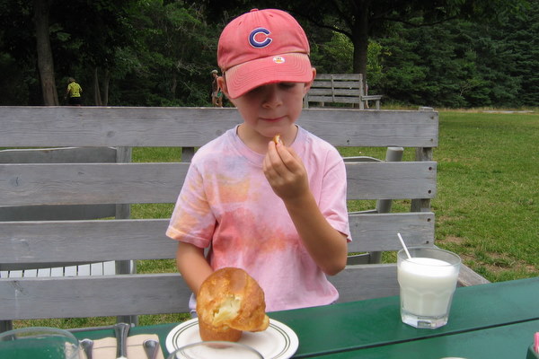
After making camp Friday night a thunderstorm came through which had me worried that we would not be able to get onto the mountains. But come Saturday morning it was hazy but not raining. We made a stop in Southwest Harbor to visit the Little Notch Bakery for breakfast and a loaf of bread then the library to check email. Then to Bar Harbor to get a map since I mailed my maps home when we left two weeks ago and pick up some cheese. By this time it was dry so we headed to the trail head.

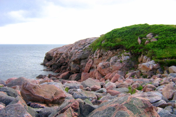
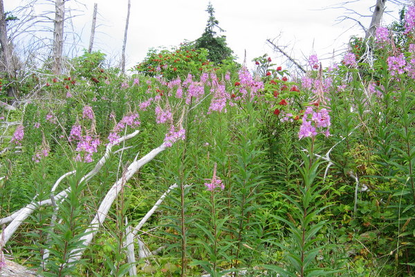
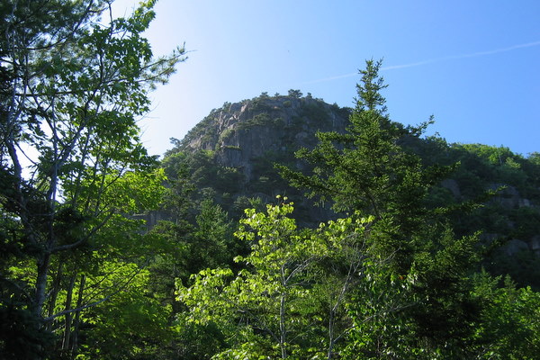
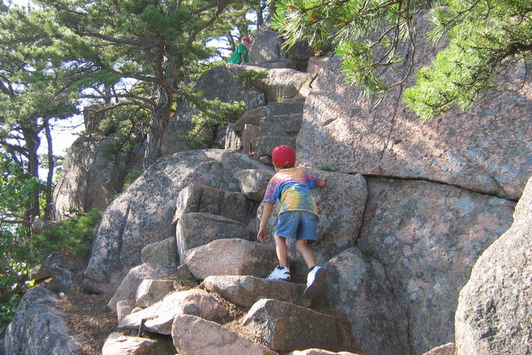
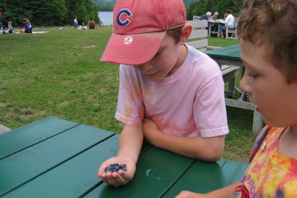
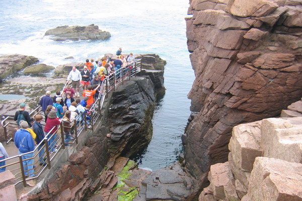
The trail we picked was the Ladder Trail up Dorr Mountain. It only had to ladders to the boys dismay. To my dismay it is mostly granite stairs going straight up the mountain. Parts of it made me think of the passage in The Return of the King where Gollum leads Frodo and Sam into Mordor by way of the stairs to Cirith Ungol. Fortunately there was no giant spider just great views and many blueberries.


The Stairs of the Ladder Trail
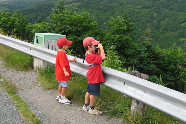
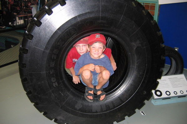
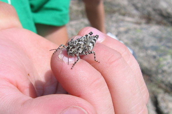
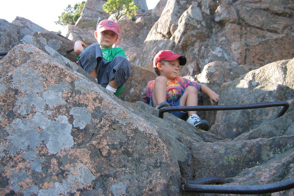
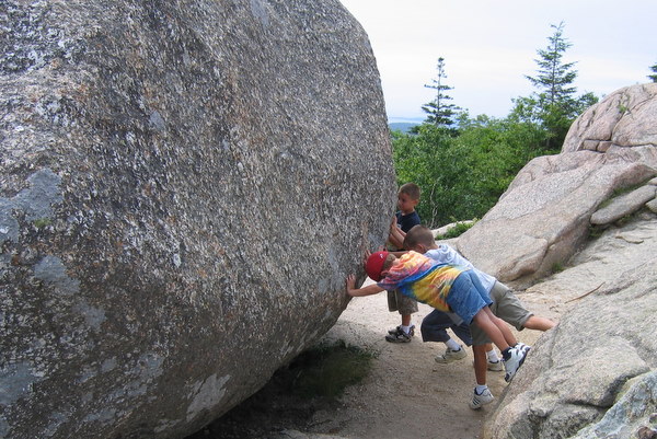

A Tight Squeeze


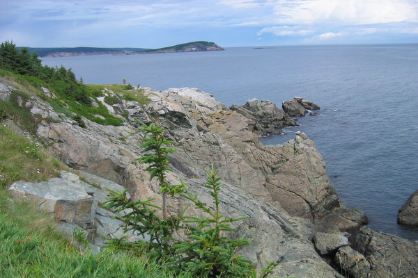
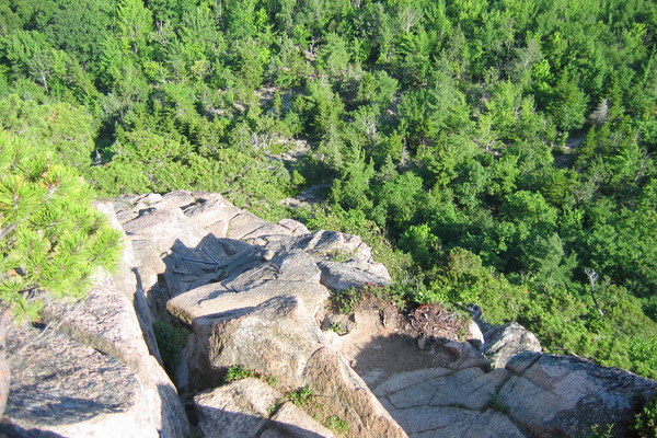
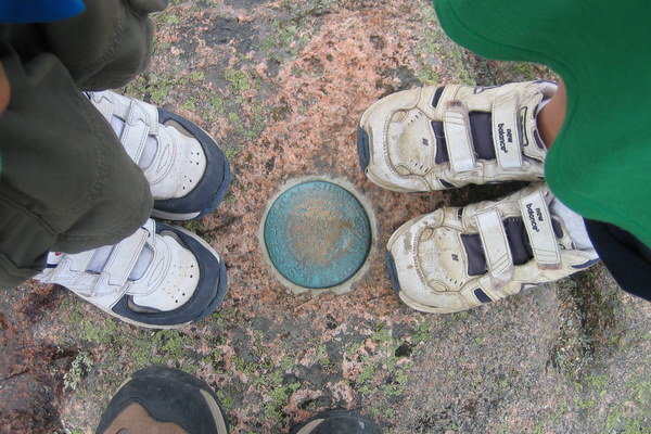
The Summit of Dorr Mountain 1270 ft

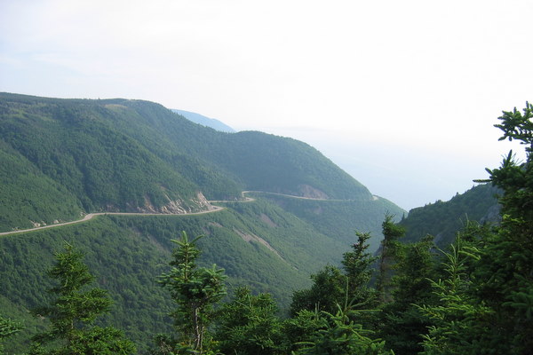
I had a few ideas of the way to take back down once we were at the summit of Dorr Mountain. But as I looked at the map and over at Cadillac Mountain I thought, "we can do that." So we extended the hike to climb up Cadillac and then down to Bubble Pond where we would catch the bus back to the car. Sounds easy.

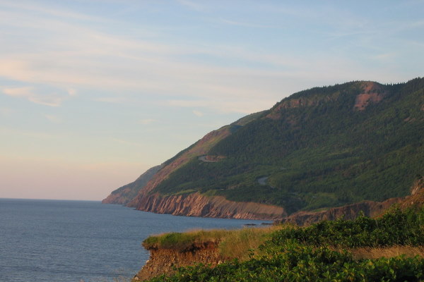
The half mile to the top of Cadillac is one hardest half miles I have hiked. The stairs up Dorr Mtn had really done me in, more than I realized. But, we made it and I lived to tell about it. We stopped to admire the view and then started down the western side to Bubble Pond. It was a hard mile and a half mostly down large slabs of granite. We made it just in time to catch the bus and soon we were back at the car. We had dinner in Southwest Harbor and that night we had a campfire. We were so tired that we didn't watch it long and went to bed.


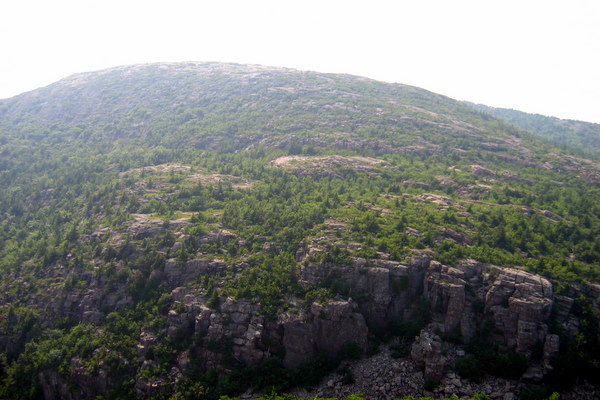
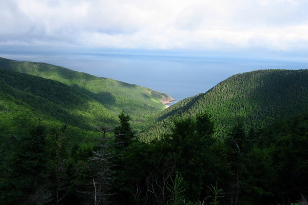
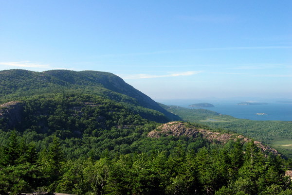
Cadillac Mountain from the Top of Dorr Mountain


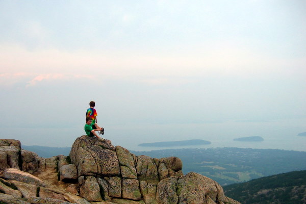
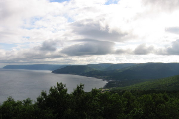
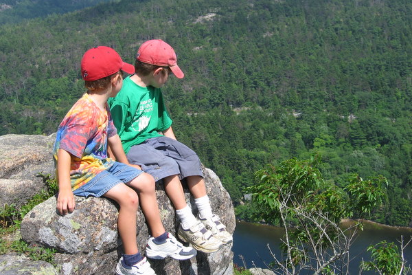
Joe and Ned Look Out Over Mount Desert Island


The Summit of Cadillac Mountain 1530 ft


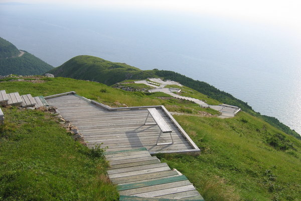
The Way Down to Bubble Pond
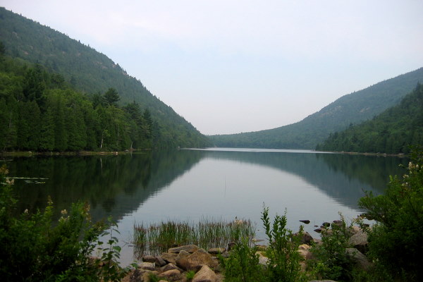

Bubble Pond


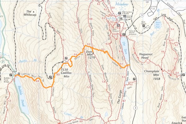
The Hike from the Tarn to Bubble Pond


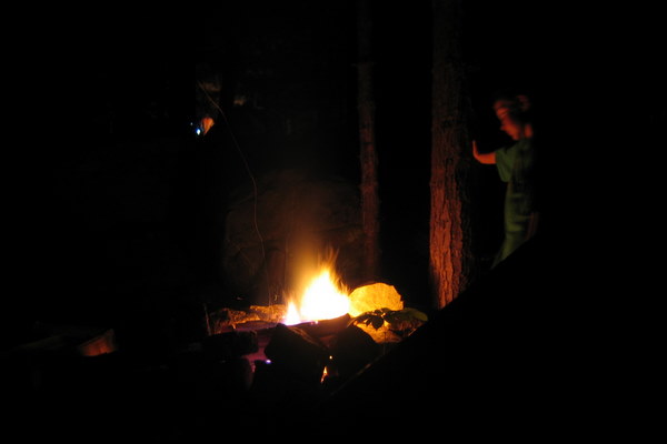
Joe Reflects Over the Day at the Campfire

Labels: , , , , ,

Sunday, July 29, 2007

Driving The Cabot Trail


Ned and Joe Posing in the Role of Moose

The next morning the weather looked like rain but it hadn't started by the time we broke camp. We set off. It would take three to four hours to drive the Cabot Trail without stops. That is impossible. Perhaps if you have driven it ten or more times you might become immune to the views. It took us almost seven hours. We stopped at many overlooks and hiked some of the trails. We drove up side roads to see waterfalls. There is still more that I would have like to see.

Our first stop other than a scenic pullout was at MacIntosh Brook. It is about a one and half mile hike through an old growth forest along a brook with small waterfalls. It was a good early morning way to loosen the legs and wake us up. The parking area has a kitchen shelter and when we finished the hike we fired up the stove and had our breakfast. While we ate it began to pour so our next stop wasn't until Beulach Ban Falls a bit further down the road. We continued along the Cabot Trail until we came to the Atlantic coast where we stopped at Green Cove.


Looking Down to Fishing Cove


The View to Pleasant Bay


I'm Telling You There are No Moose!

Green Cove is a small rocky headland that juts out into the ocean. It is formed of some really neat boulders of pinkish rock with intrusions of a highly crystalized granite forming lines and crosses. Down the road from there we turned down a side road to view Mary Ann Falls. They were crowded and there were people swimming the pools beneath them.


Green Cove


Joe and Ned Clamboring Over the Boulders

Our last stop along the Cabot Trail was to hike Middle Head. Middle Head is a long headland creating North and South Ingonish Bays. It is a two and half mile hike starting at the Keltic Lodge. The hike goes through some forests and meadows and has rocky cliffs on the sides and at the end for great views up the coast and to Cape Smokey to the south.

Wildflowers


Go Ahead Jump


The End of Middle Head


The Keltic Lodge Near Ignonish, NS

After the hike we said goodbye to the Cabot Trail and headed for the Southeast corner of Cape Breton Island taking the ferry at Englishtown and camping south of Sydney, NS at Mira River Provincal Park.


The Englishtown Ferry


Chéticamp, NS to Mira River, NS, 165 miles 8 hrs 28 min

Labels: , , , , , ,

Saturday, July 28, 2007

To Cape Breton Island


The Cabot Trail

From Halifax we headed for Cape Breton Island and the Cabot Trail. Along the way we stopped in Stellarton to visit the Nova Scotia Museum of Industry. It is a hands on exploration of the industries in Nova Scotia from the past to the present. We were early so some displays were not quite set up but the boys had a good time.


Ned the Engineer


Tire Boys

Crossing the Canso Causeway we entered Cape Breton Island. At this point there are a number of ways to go and I decided to take the northerly, coast hugging Highway 19 the Ceilidh Trail. It is a pretty drive and we soon arrived in Chéticamp which for us was the beginning of the Cabot Trail.

The Cabot Trail is a 180 mile drive around the northern part of Cape Breton Island most of it being inside Cape Breton Highlands National Park. It is a beautiful drive with many pulloffs to view the vistas of deep valleys, mountains and ocean.

After we arrived in Chéticamp we made camp at the National Park's Chéticamp campground. It was early so we headed up the Cabot Trail a few miles to hike the Skyline Trial. The Skyline is 6 mile loop that goes out onto a headland about 950 ft above the ocean. Views are spectacular. The trail back is through a forest where moose are often spotted. We saw lots of moose sign but the only mammal was a lone ground squirrel. The woods were full of bird calls clear and bright.

On the way back to the campsite we saw a group of people on the side of the road with cameras. Slowing down to take a look we saw they were looking at a bull moose. He was munching his way around a shrub. He would be our only moose sighting. Other travellers I talked to reported seeing mothers and calves, two bulls, black bears and cubs, and bald eagles. One woman from the Netherlands told me they saw six moose. We saw only the one moose and ground squirrels. Bird wise is was terns, gulls, cormorants and crows.


The Cabot Trail Looking South


The Skyline Trail Boardwalk


Wildflowers and Tree Trunk


Our Only Moose


The Cabot Trail Winding Its Way North


Halifax, NS to Chéticamp, NS, 266 miles 7 hrs 8 miin

Labels: , , , , , ,

Tuesday, July 24, 2007

Mountains of Acadia


Atop Beech Mountain

Our last day in Acadia National Park was one up and down, literally. We walked across tidal pools and climbed two of the smaller maountains in the park.

We started in the morning for the western part of Mount Desert Island driving to the bustling town of Southwest Harbor. Southwest Harbor is very nice. I thought it much nicer than even Bar Harbor since the throngs of tourists (yes we were there but we are not much of a throng though the boys attempt to be sometimes) are absent. There is a very good bakery and grocery store and the library is wonderful.

From there we drove along route 102A to the natural seawall and explored the tidal pools. They were filled mostly with snails and kelp. Driving on we stopped at the Bass Harbor Head Lighthouse one of the most picturesque lighthouses in Maine. The highlight for the boys was climbing the huge rocks and watching a lobsterman pulling up his traps, emptying them and sending back to the depths.


Bass Harbor Head Lighthouse


A Lobsterman Checking His Traps

Next stop was Echo Lake where we had lunch. After lunch we climbed Beech Mountain. The trail from Echo Lake is called Canadian Cliffs. It is a ladder trail which means that there are ladders fastened to the cliff face to help your ascent. Once at the top we took the Beech Cliffs loop for some great views. Coming down the ladders was the hardest part of the trail.


Joe and Ned Ascend a Ladder


The Canadian Cliffs Trail


Atop Beech Mountain


A Camouflaged Grasshopper Cannot Escape Joe

After this climb we were ready for, another climb. This time we went back to the eastern part of the island to tackle the Beehive. Not as challenging as the Precipice trail which climbs 1058 ft Champlain to the north the Behive is only 520 ft. The Behive is another ladder trail up the southern face. There are no ladders on this trail but iron rungs pounded into the granite cliff face to use as handholds or footholds. The boys were loving it and I had to call to them to slow down. We came down a trial that goes around the back of the Beehive by a hidden pond called the Bowl. The trail was laden with blueberries (note the "was") and the pond had beaver lodges and many frogs.


At the Start of the Beehive Trail


Our Goal the Beehive


Up the Side of the Beehive


Taking a Rest on One of the Ladder Sections


Don't Look Down!


The View From the Top


Blueberries on the Trail

After a late dinner we went to Sand Beach to partake in Stars Over Sand Beach though we left early since it was late and we had to break camp in the morning to catch our ferry in St John.

Acadia National Park was as beautiful and glorious as remember it from 20+ years ago when I last visited. Bar Harbor and the park was much more crowded though we were there at the height of the season. There were many things we didn't see or do like biking on the carriage trails but that only means we will have to come back and spend more time. One thing is for sure I am not going to wait another 20 years to return and Mary is coming with me.

Labels: , , , , ,

Monday, July 23, 2007

Acadia National Park Hiking and Rain


It is Time to Get Up!

Monday we were up early to meet a park ranger for a hike up South Bubble. The theme of the hike was "Mountain Mysteries" the geology of Mount Desert Island. The main attraction for the boys was Bubble Rock. It is a large erratic deposited by the glaciers of the last ice age that seems to be balanced on the edge of the mountain.

After the hike we went down to the Jordan Pond House for lunch. We all enjoyed the pop overs and the boys went into the bushes and found blueberries. The weather started to turn to rain after lunch and instead of hiking some more we hopped in the car made a stop at the visitors center where Joe and Ned received their Junior Ranger badges Then we drove the park loop road stopping at Thunder Hole.

After dinner we went to the ranger program at the campground but the rain became to heavy and we headed off to bed.


Metamorphic Rocks are Like Play-Doh


Where is Bubble Rock From?


Are They Ones to Push Over Bubble Rock?


Joe Samples a Popover on the Lawn at Jordan Pond House


Joe Shows off his Haul of Blueberries


Joe and Ned are Tested for Junior Ranger


The Boys Take Their Junior Ranger Oath


The Precipice Trial up Mount Champlain


Thunder Hole at a Quiet Moment

Labels: , , , , ,

Thursday, July 12, 2007

Hike to Nowhere


Joe and Ned, Showing off His Scraped Knees, on the Trial to Flat Rock Vista

Today the boys and I went on a hike. I picked the Flat Rock Trail to the Flat Rock Vista overlooking the Cumberland Valley. It starts in Colonel Denning State Park and goes straight up the side of the mountain for 2.5 miles.

I found out that I need to do some more walking. We were about three fourths of the way up the trail when I started feeling bad. We were about a tenth of mile from the top and the vista when I had to stop. Joe was very concerned and was glad that I chose to return the trailhead. After getting back down and having a rest I felt better.

We took the long way to the park and drove on a number of logging roads through state forest lands. It was a beautiful day other than the part of the hike where I thought I was going to pass out.

We went into Carlisle for dinner and stopped by the burial ground to visit one Carlisle's more famous dead, Molly Pitcher. The boys really liked the graveyard and we spent some time counting the number and kinds of veteran flags next to graves. We found quite a lot of Revolutionary and Civil War veterans along with the occasional War of 1812, Spanish American War and WWI.


Joe and Ned Standing in Front of Molly Pitcher


Carlisle to Colonel Denning State Park 70 miles 5 hrs 20 min

Labels: , , , , , ,